
In the early 1940s, map layers were drafted by hand using pen and ink on translucent acetate sheets mounted on large Strathmore boards. They were drafted at larger sizes than needed for the final (typically at a 4:1 ratio) and printed at a reduced size using photomechanical methods. Standard symbols and labels preprinted on adhesive-backed cellophane sheets called “stick-up” were applied to maps for uniformity.
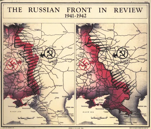
During this decade, in support of the military’s efforts in World War II (WWII), cartographers pioneered many map production and thematic design techniques, including the construction of 3D map models. Cartographic support was key to the US war-planning strategy. In addition to the major events of WWII, during the 1940s, cartographic production was primarily driven by postwar reconstruction, turmoil in the Middle East, and communist expansion.
https://www.cia.gov/news-information/featured-story-archive/2016-featured-story-archive/mapmakers-craft.html

No comments:
Post a Comment
Note: Only a member of this blog may post a comment.